Chapter/Index: Introduction | A | B | C | D | E | F | G | H | I | J | K | L | M | N | O | P | Q | R | S | T | U | V | W | X | Y | Z | Appendix
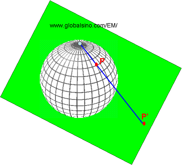
| Stereographic projection was originally developed to project a sphere onto an infinite plane. Figure 4125a shows a sphere sits on a green plane and the point P on the sphere is projected onto the point P’ on the plane.
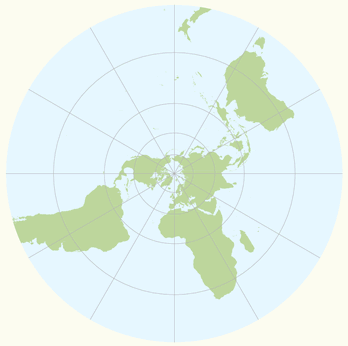
Figure 4125a. Schematic illustration of stereographic projection. As a simple example, stereographic projection is a convenient way to make a flat map of the earth. Because the earth is spherical, the map must distort the shapes or sizes of the earth to some degree. Imagine the earth is a transparent sphere, sitting on the plane of a paper, and the south pole touches the paper. The next is to imagine a point light at the north pole, which shines through the sphere. Each point (location) on the sphere (earth) projects a shadow on the paper, illustrating the map as shown in Figure 4125b. The south pole appears at the center point of the map. Circles around this center represent the latitude lines. In the map, the dimension near the south pole is not stretched significantly, but the equator is twice as big on the map as on the sphere and the northern hemisphere is stretched quite a bit (in principle, the north pole is sent off to infinity even though the actual paper cannot be infinitely large).
Figure 4125b. Stereographic projection of the earth.
|